High Precision for Everyone, Anywhere
Aurora Navigation makes high-precision positioning accessible and affordable for users across industries and around the world.
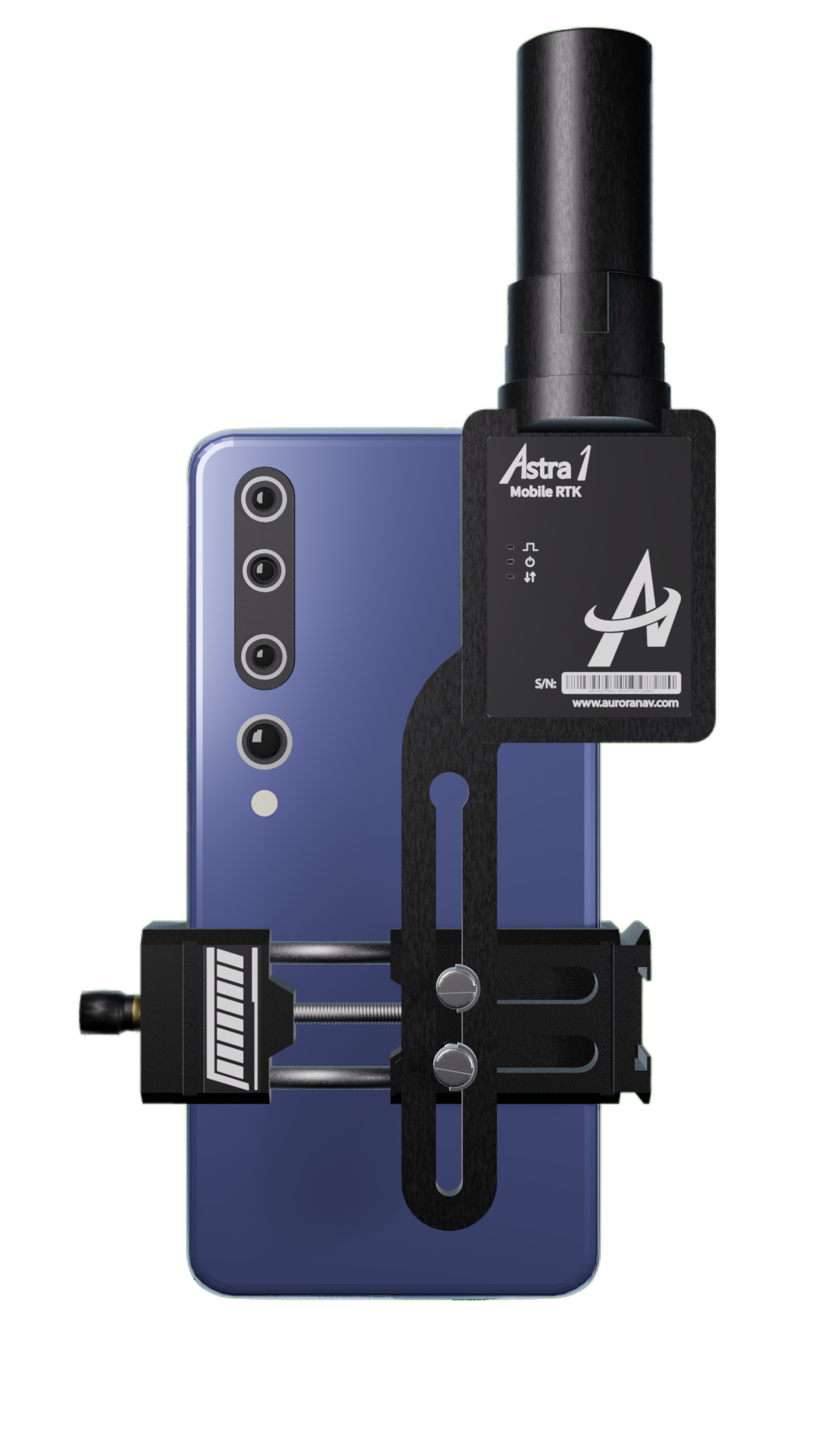
Astra1 Mobile Visual RTK
Compact, professional-grade mobile RTK receiver delivering fast and reliable centimeter-level positioning and 3D mapping for your cellphone

Geo-referenced 3D scanning

Remote points survey

All constellation, multiple frequencies

Ultra-Compact. Field-Ready
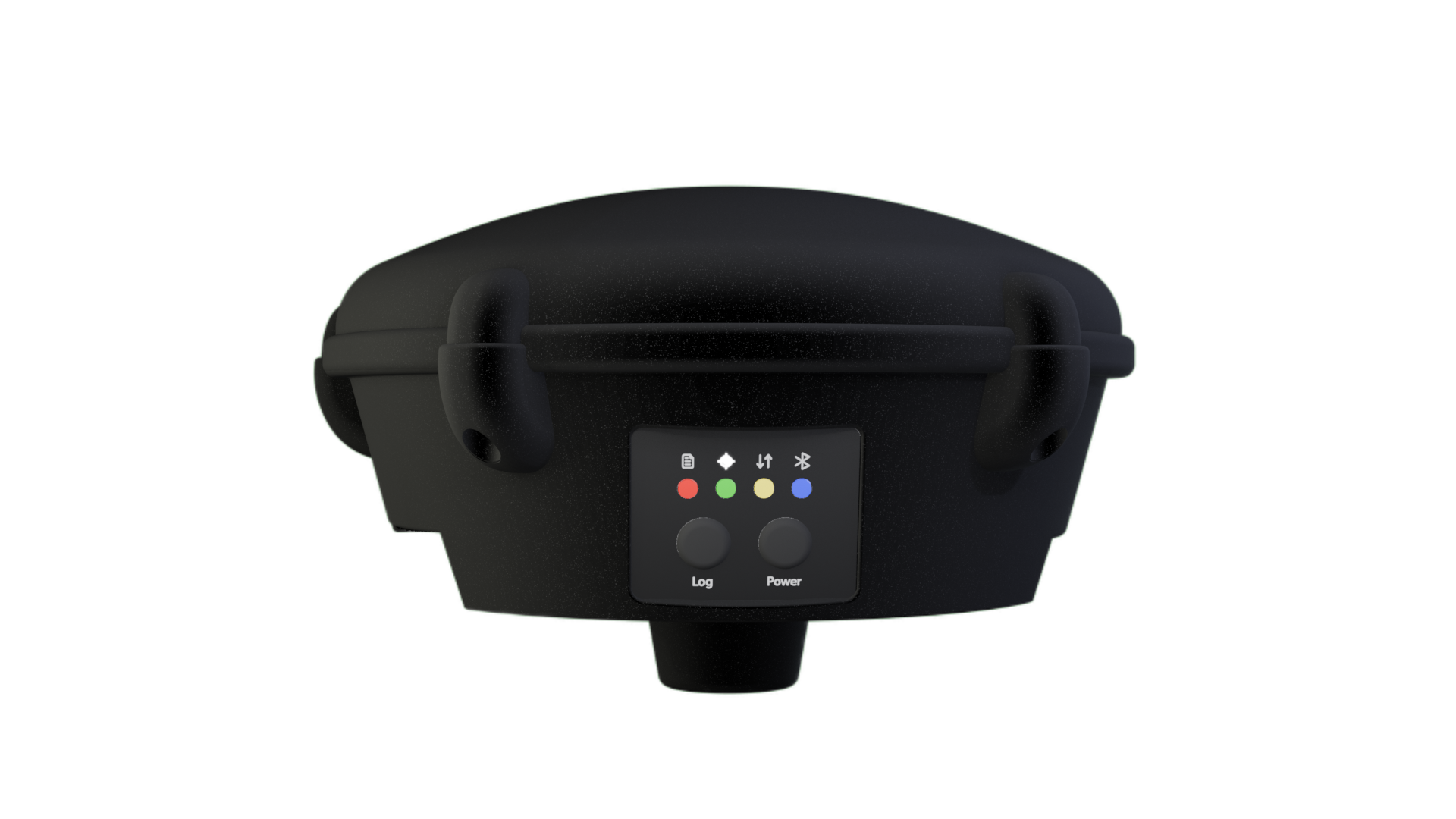
G1000 GNSS Receiver
Long-Range RTK, All-Day Operation, Survey-Grade Accuracy
–40 °C, 25+ hours battery
Reliable RTK with AI
All constellation, multiple frequencies
Up to 25 km radio
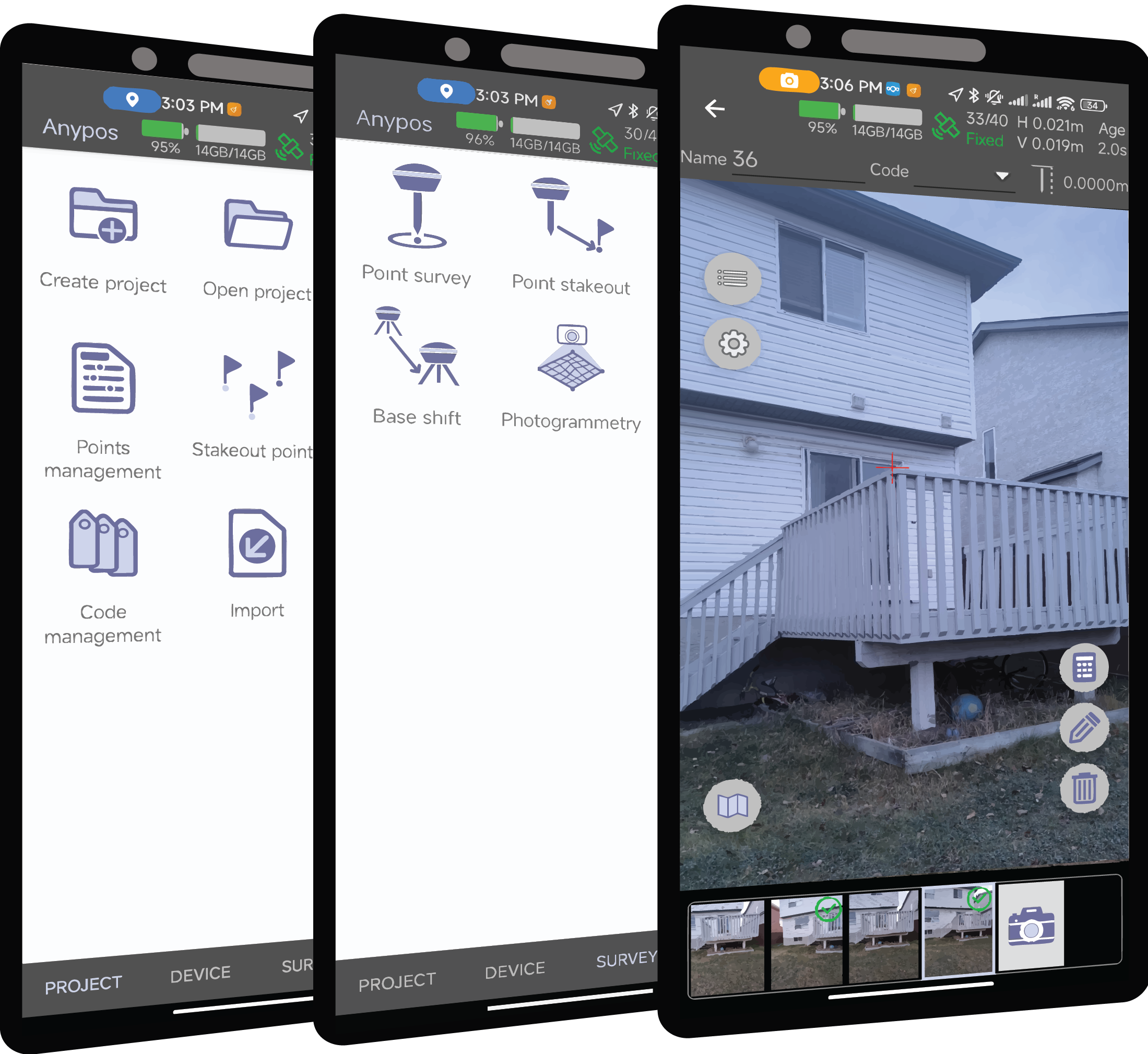
Anypos Survey APP
A professional survey APP meets all your need

Versatile project configurations
Survey and stakeout
Photo survey

Georeferenced 3D scanning
Need help? Contact our team
Whether you have a question before buying, or need help using our product, contact Aurora Navigation team and we will reach you as soon as possible.