Measure What You Can’t Reach
Walk to the point. Level the RTK rover. Record the coordinate. This simple workflow is what makes RTK surveying so efficient. However, real projects are rarely that straightforward.
Every surveyor eventually encounters points that are difficult, dangerous, or just impossible to occupy. They might be a roof corner, a point hidden beneath dense canopy, the far side of a river, or a bridge component suspended above traffic.
Yet the coordinate is still required.
Traditionally, surveyors either switch to a total station, request access to restricted areas, or accept additional time and safety risks. None of these options fit naturally into an otherwise efficient RTK workflow.
This is why the Remote Point Survey was developed. Instead of physically occupying that point, it captures that point remotely. And that is the breakthrough of modern Visual RTK systems, to determine the target’s coordinate without even placing the receiver there.
The workflow remains simple:
(1) Capture a few photographs.
(2) Select the target.
(3) Obtain the coordinate instantly.
This isn’t just another feature listed on a specification sheet. It’s a different way of thinking about field work.
In this article, we break down:
- What Remote Point Survey is and where it adds the most value.
- How smartphone-based Visual RTK determines the coordinates of inaccessible points.
- The field conditions and camera geometry that have the greatest impact on accuracy.
- How accurate Remote Point Survey can realistically be.
- When Remote Point Survey is a better choice than a total station—and when it isn’t.
When Does Remote Point Survey Make Sense?
Like every surveying tool, Remote Point Survey has situations where it shines and others where conventional methods remain the better choice.
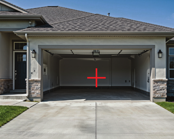
It works best when the target is visible but difficult to occupy.
Some common examples include:
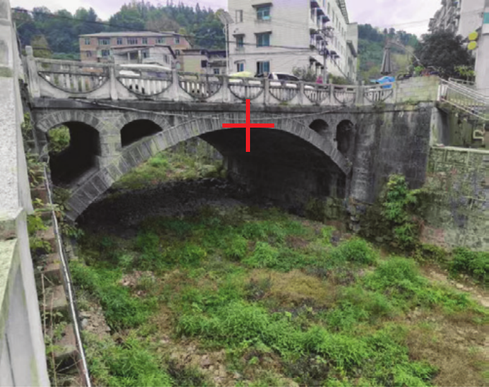
Hard to Reach
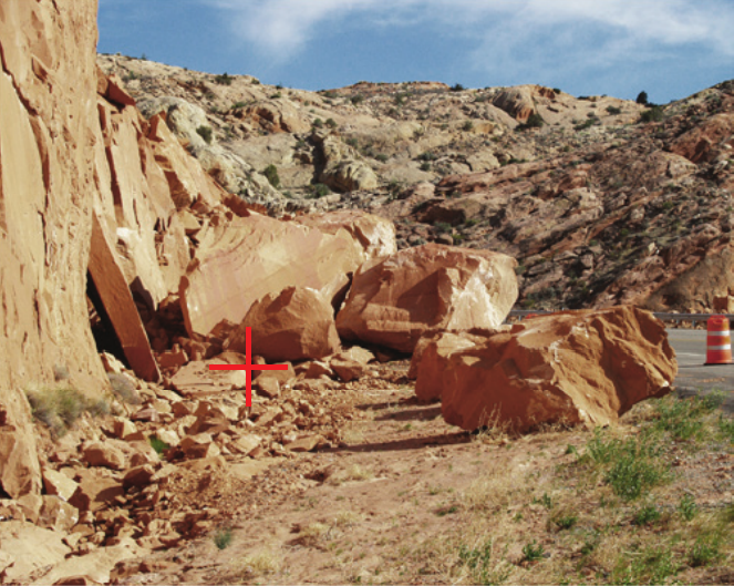
Unsafe
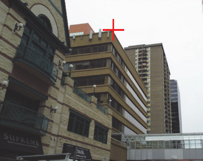
Elevated
GNSS Challenged
It’s simply that the point cannot be occupied efficiently or GNSS signals are blocked. Remote Point Survey transforms those situations from special cases into ordinary RTK measurements.
Instead of changing equipment, you simply change how the coordinate is collected.
How Does Remote Point Survey Actually Work?
At first glance, Remote Point Survey almost feels like magic. You capture a few photographs, tap a point on the screen, and a three-dimensional coordinate appears.
No laser, no reflector, no measuring tape. Remote Point Survey doesn’t measure distance directly. Instead, it determines where multiple observations intersect in space.
Think about how you locate a mountain peak. Standing in one place, you can point toward the peak, but you don’t know exactly how far away it is. If another person stands somewhere else and also points toward the same peak, the two directions immediately provide much more information. Add a third observer from another location, and the position of the peak becomes even more constrained.
Remote Point Survey works exactly the same way. Instead of pointing toward the target, the software uses photographs captured from different locations. Like estimating where each person is standing, RTK provides centimeter-level camera positions. That is why RTK matters.

Instead of approximating the viewing direction, computer vision calculates exactly where every camera was pointing. Once those pieces are known, the coordinate of the target can be computed through triangulation. Despite the sophisticated mathematics behind, the workflow is remarkably straightforward:
- Capture several overlapping photographs.
- Select the same point in multiple images.
- Let the software calculate the coordinate.
- You are able to verify the remapped point in un-marked images.
See Photo Survey Real World Demo with AuroraNav Astra1.
What Has the Greatest Influence on Accuracy?
Many users assume the camera is the most important factor. In reality, camera quality is only one piece of the puzzle.
The biggest contributors to accuracy are usually:
- RTK positioning quality – Every photograph starts with the camera position. Poor RTK positioning limits everything that follows.
- Camera geometry – Strong viewing angles often improve accuracy more than additional photographs.
- Distance to the target – The farther the object, the more carefully geometry must be planned.
- Image quality – Blurry photographs or poor lighting make feature identification more difficult.
- Point selection – Selecting exactly the same feature in every image is essential, especially for distant targets.
- Image resolution Higher resolution image contribute more to longer distance.
Among these factors, geometry is often the one the surveyor can improve most easily in the field. Sometimes walking another five metres produces a greater improvement than upgrading to a higher-resolution camera.
Remote Point Survey vs. Total Station
Both remote point survey and total station survey remotely, but they are different.
Remote Point Survey is not designed to replace a total station. It solves a different problem.
A Total Station Excels at Precision
If your project requires millimetre-level accuracy, precise stakeout, deformation monitoring, or engineering control, a total station remains one of the best tools available.
It measures horizontal angles, vertical angles, and distances directly, making it ideal for applications where precision is the highest priority. However, that level of precision comes with additional setup.
The instrument must be positioned carefully. The backsight must be established. Line of sight must remain unobstructed. In many situations, surveyor is also required to hold the prism.
For complex engineering projects, these extra steps are completely justified. For measuring a single roof corner with centimeter accuracy requirement, total station is just too heavy.
RTK Is Still the Fastest Choice
Speed is one of the most important advantages that people uses RTK when every point can be occupied safely. The workflow is quite straightforward, walk to the point, level the pole, record the coordinate.
Remote Point Survey doesn’t improve this workflow because there is no problem to solve. If the point is easy to occupy, simply occupy it using RTK.
The Gap Remote Point Survey Fills
Imagine a situation, where everything has been surveyed using RTK, except points happen to be:
- on a roof,
- under canopy
- across a river,
- or suspended over traffic.
Instead of setting up a heavy total station, changing workflows, or changing safety procedures, surveyors can simply continue working with the equipment already in their hands:
(1) Capture several photographs.
(2) Select the point.
(3) Continue the survey.
Remote Point Survey fills the gap in this scene.
It’s About Choosing the Right Tool
Professional surveyors rarely rely on a single instrument.
Instead, they choose the tool that makes the most sense for each task.
The same philosophy applies here.
| Task | Recommended Tool |
|---|---|
| Topographic survey | RTK |
| Control survey | Total Station or RTK |
| Construction layout | Total Station or RTK |
| Roof corner | Remote Point Survey |
| Utility pole | Remote Point Survey |
| Bridge beam | Remote Point Survey |
| Opposite river bank | Remote Point Survey |
| Building façade | Remote Point Survey |
| Millimetre monitoring | Total Station |
Notice that these technologies don’t compete with each other. They complement each other.
Remote Point Survey isn’t trying to replace decades of proven surveying techniques. It’s simply removing one of the most common interruptions in an traditional RTK workflow.
Summary
Remote Point Survey is about something maintaining an efficient workflow. Every survey project contains moments where progress slows down—not because measuring a coordinate is difficult, but because accessing the point is.
- A roof corner requires permission.
- A utility pole requires traffic control.
- A retaining wall requires climbing.
- An under canopy point that is out of GNSS signal reach
- A fence requires access.
Individually, these delays may only add a few minutes. Across an entire project, they become hours. Remote Point Survey changes that equation. Instead of adapting your workflow to the point, you just smoothly proceed with the tool already in your hand.
To see how smartphone-based Visual RTK makes this workflow possible, explore Astra1 Mobile Visual RTK and watch the field demonstrations on our website.
Learn more: https://www.auroranav.com/product/astra1-mobile-rtk/