-
What Metric Should You Use to Evaluate the Accuracy of Your Current RTK Measurements
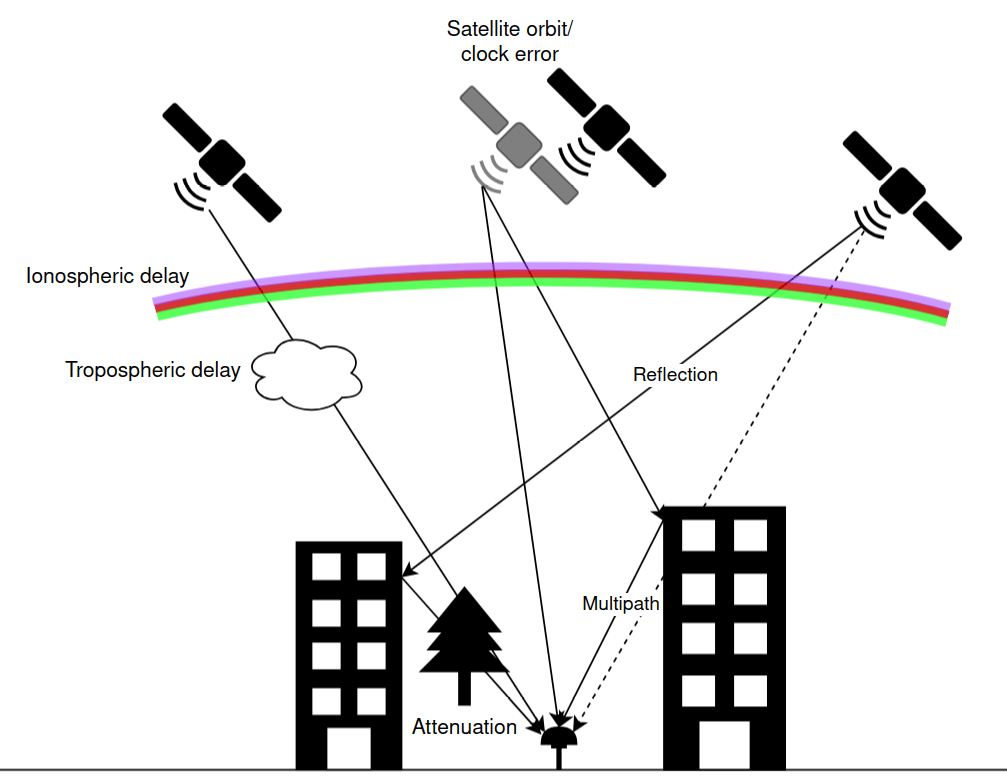
RTK receivers provide a variety of indicators and statistics, but which one actually tells you whether your measurement is trustworthy? Many surveyors and GIS professionals instinctively rely on the FIX indicator or the reported RMS accuracy. While these metrics are useful, they do not always reflect the true accuracy of your position. Short answer: If…
-
How Multi-Frequency GNSS Improves Accuracy in Surveying, Mapping, and RTK/ PPP Positioning
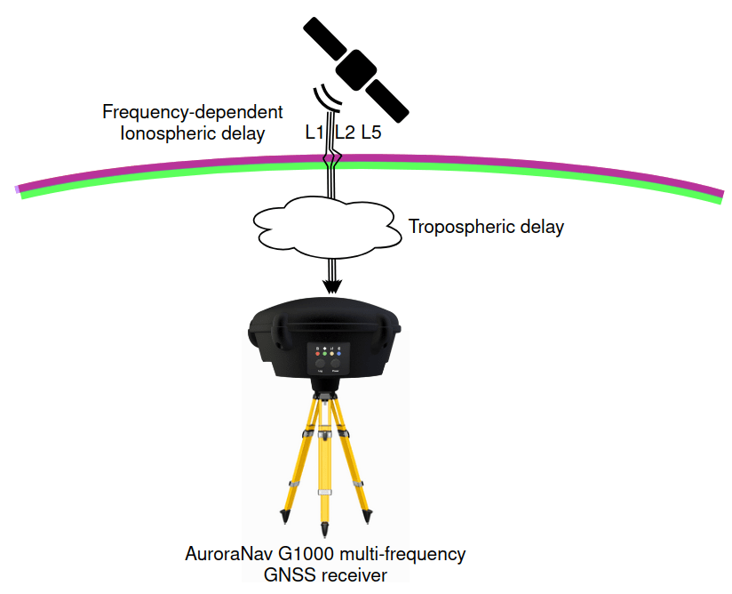
Global Navigation Satellite Systems (GNSS) have become essential in surveying, mapping, agriculture, construction, and navigation. Performances of GNSS receivers can vary a great deal. One of the biggest deciding factors for positioning performance is whether a receiver supports single-frequency, dual-frequency or multi-frequency GNSS. So, how exactly does multi-frequency GNSS improve accuracy? In this article, we…
-
RTK vs PPP: Key Differences, Accuracy, and When to Use Each
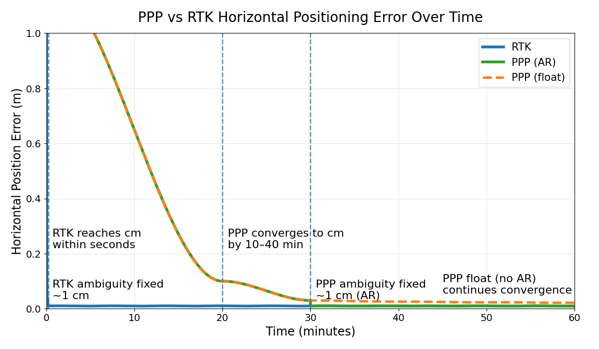
Real-Time Kinematic (RTK) and Precise Point Positioning (PPP) are two of the most widely used techniques in high-precision GNSS. At first glance, both can deliver centimeter-level accuracy. What is exactly the difference between them? When should you choose RTK and when to PPP in your real-world project? In this article, we break down: The key…
-
PPP GNSS: Corrections, Convergence Time and Accuracy Explained
Precise Point Positioning (PPP) is a GNSS positioning technique that allows a single receiver to achieve centimeter-level accuracy without a base station. But how does PPP actually work? Why does it take 10–40 minutes to converge? And what is the realistic accuracy that PPP can achieve? In this guide, we break it down in plain…
-
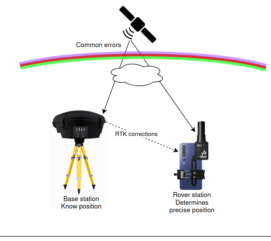
RTK GNSS Explained: How Real-Time Kinematic Achieves Centimeter Accuracy
For years, Real-Time Kinematic (RTK) has been a fundamental technology in surveying, drone mapping, construction, precision agriculture, and robotics. While standard GNSS positioning typically provides meter-level accuracy, RTK dramatically improves this to centimeter-level accuracy in real time by using carrier-phase measurements and differential observations from a nearby reference station. But how exactly does it work?…
Categories