-
RTK GNSS Explained: How Real-Time Kinematic Achieves Centimeter Accuracy
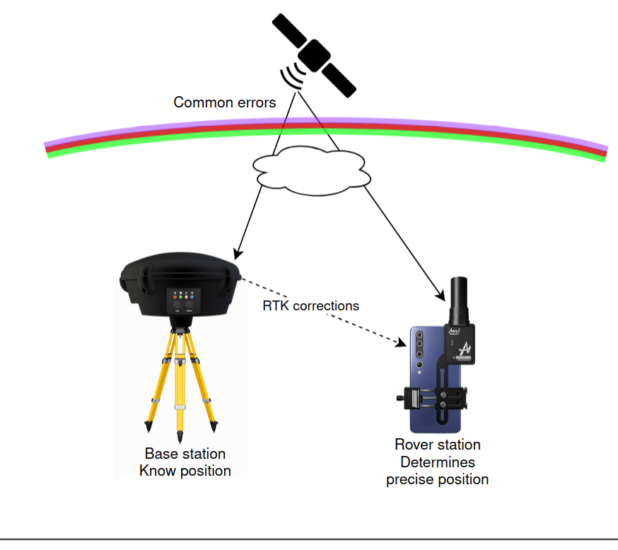
For years, Real-Time Kinematic (RTK) has been a fundamental technology in surveying, drone mapping, construction, precision agriculture, and robotics. While standard GNSS positioning typically provides meter-level accuracy, RTK dramatically improves this to centimeter-level accuracy in real time by using carrier-phase measurements and differential observations from a nearby reference station. But how exactly does it work?…