-

Remote Point Survey: A Practical Guide to Measuring Inaccessible Points
Measure What You Can’t Reach Walk to the point. Level the RTK rover. Record the coordinate. This simple workflow is what makes RTK surveying so efficient. However, real projects are rarely that straightforward. Every surveyor eventually encounters points that are difficult, dangerous, or just impossible to occupy. They might be a roof corner, a point…
-
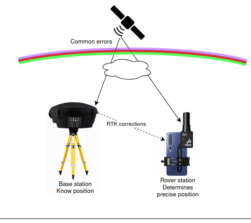
RTK GNSS Explained: How Real-Time Kinematic Achieves Centimeter Accuracy
For years, Real-Time Kinematic (RTK) has been a fundamental technology in surveying, drone mapping, construction, precision agriculture, and robotics. While standard GNSS positioning typically provides meter-level accuracy, RTK dramatically improves this to centimeter-level accuracy in real time by using carrier-phase measurements and differential observations from a nearby reference station. But how exactly does it work?…
Categories